Protecting Point Lobos
The special purpose of a reserve is to forever protect an area of unique natural beauty and ecological significance. Afforded a higher level of statewide protection and ideally maintained in an undisturbed condition, the behavior of visitors has a tremendous impact on the health of Point Lobos State Natural Reserve.
Rapidly increasing numbers of well-meaning and uninformed visitors are damaging precious natural resources found within Point Lobos State Natural Reserve. Please do your part to be informed. Understand how your behavior impacts these resources, and help others understand as well. Sharing the knowledge will help ensure future generations can experience the wonders of Point Lobos, as we are fortunate enough to do today.
Does my behavior impact wildlife?
Point Lobos State Natural Reserve is home to a diversity of wildlife and visitors are fortunate to have the opportunity here to witness the natural cycle of life, from birth to death. Behaviors like yelling to get the attention of a harbor seal and her nursing pup, chasing nesting birds through the rocky outcroppings, or attempting to get close to wildlife for a photo can disturb and harm these animals. Disturbed animals may abandon their young or put themselves in harm’s way to be protected. Oftentimes, visitors are not intending to cause harm and do not understand how their behavior impacts these resources. Please be an informed visitor.
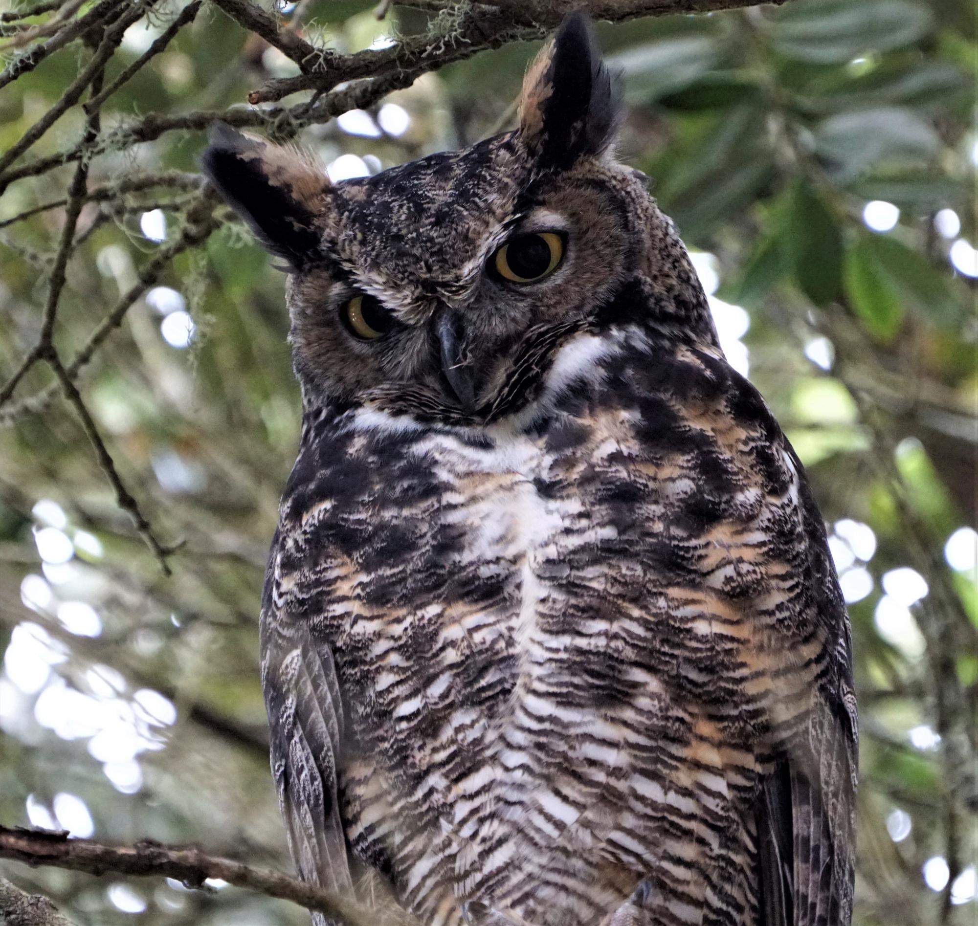
Great Horned Owl in Point Lobos State Natural Reserve. Photo credit: Jerry Loomis.
Why should I stay on marked trails?
Recent research showed that there are more than 85 “unofficial” trails created by visitors today. Your boot or sneaker-clad foot can do enough damage in one second that takes years to undo. Unofficial trails (those created by visitors walking repeatedly off-trail through natural vegetation) harm the habitat and important food sources provided by that vegetation. When the vegetation is lost, erosion becomes a problem. Please stay on marked trails.
Does it really matter if I collect shells?
We all have the impulse to take something home from a place as special as Point Lobos. Be it an abalone shell, a trace fossil, or coral from the tide pools at Weston Beach. Each of these resources play a vital role in making Point Lobos as special as it is today. Some of them provide habitat for living animals, some merely a glimpse into the past. Please leave them at the Reserve so others can enjoy and learn from them.
![]()
Diving at Point Lobos
As a diver, one can enter into a forest of giant kelp to visit a variety of dive areas, starting at Whalers Cove. The depth of the water extends to about 70 feet at middle reef. The underwater seascape is dotted with boulders and valleys that allow the underwater explorer to continuously scan the area for schooling fish, encounter the company of curious harbor seals or otters, and take in multicolored anemones and other bottom-dwelling creatures adorning rock faces and nestled in every crevice.
Thanks to the efforts of the local dive community and the generosity of many donors, a 3D Model of the Point Lobos State Marine Reserve Dive Areas was installed at Whaler’s Cove on May 10, 2014. This unique model provides divers with landmarks to navigate the Reserve, and allows non-divers to visualize the underwater wonders – without getting wet! We invite you to visit this model (click here for a printable version) and explore the amazing underwater seascape.
Diving is permitted only in Whalers Cove, Bluefish Cove, and nearby waters, and is tightly controlled by strict safety regulations. A reservation system limits the number of divers on any given day. Any questions or concerns can be submitted by email to samantha.shackelton@parks.ca.gov.
See Point Lobos SCUBA Diving on the CA Department of Parks and Recreation website for information on diving regulations, reservations, locations, and other things you need to know. The Printable Dive Map includes specific information on dive sites within Point Lobos State Natural Reserve.
Rules and Regulations
1. Diving permits are limited to 15 teams per day. Each permit is for a team of two divers. Diving alone is not permitted. All divers must have a partner.
2. All divers on the team must be present to be registered. A valid diver certification card must be in your possession at the time of registration. If the card does not have a photo on it, you may be asked for other photo identification.
3. All SCUBA divers must have a device capable of maintaining positive buoyancy.
4. Divers and boats may enter or exit the water only at the access ramp at Whalers Cove parking lot.
5. The diving area is limited to Whalers and Bluefish Coves. All other areas of the Reserve are closed to diving. Snorkeling is NOT permitted at China Cove or Gibson Beach.
6. No dive teams or boats will be permitted to register less than two hours prior to the Reserve’s posted closing time. Closing times are subject to change; check with the kiosk for current closure times.
7. No fishing equipment or collecting tools are permitted in the Reserve. All animals, plants, and natural features in the Reserve are fully protected.
8. The Federal Marine Mammal Protection Act and State laws prohibit you from disturbing or harassing marine mammals. Be cautious in the areas where there are nesting birds, they frighten easily. Please keep your distance!! If you approach seals, otters, whales, or seabirds and notice they are alerting to your presence then you are too close. You need to change your direction and move farther away from the wildlife.
9. Remember, there are areas and beaches that are closed to the public for the protection of wildlife. Do not come ashore at these locales; including, but not limited to, Headland Cove, Bluefish Cove, and Whalers Cove. Personal watercraft (aka. Jet-Skis) are prohibited in the outlined area on the dive map, but NOAA regulations do allow for the use of Motorized Personal Watercraft (MWPC) within four year-round operating zones, as well as one seasonal zone, within the Monterey Bay National Marine Sanctuary. Please visit the NOAA website at https://montereybay.noaa.gov/